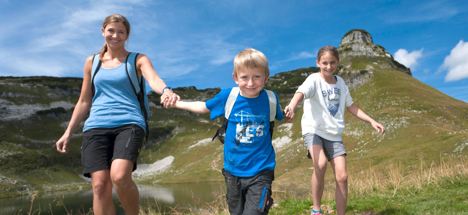
Hiking
The Loser. My adventure mountain.
The impressive Loser scenic gondola lift makes the natural treasure in the borderland between Upper Austria and Styria accessible to the hiking and nature lover.
Already discovered, hiked and loved by Sisi, Empress Elisabeth of Austria-Hungary, the Loser is today the center of alpine sports and hiking center in the Salzkammergut.
The impressive Loser scenic road (9km) makes the natural treasure in the borderland between Upper Austria and Styria accessible to the hiking and nature lover.
From the Loser plateau numerous trails and routes of all difficulties lead to the most significant peaks and most beautiful lookout spots in the Salzkammergut.
No matter if recreation seekers, nature lovers or mountaineers, on the Loser everybody finds their perfect tour. Let your spirits flow at the Augstsee, right above the Loser Alm and explore nature.
Insights and outlooks can be expected at the Loserfenster hiking trail, during the visit of the Schafkirche cave and during the view through the Loserfenster, a window to the soul of the landscape.
No matter if alone, in good company or with a guided tour, the Loser, Sisi's favorite mountain, offers strollers, hikers and mountaineers likewise an imperial spectacle.
Loser map
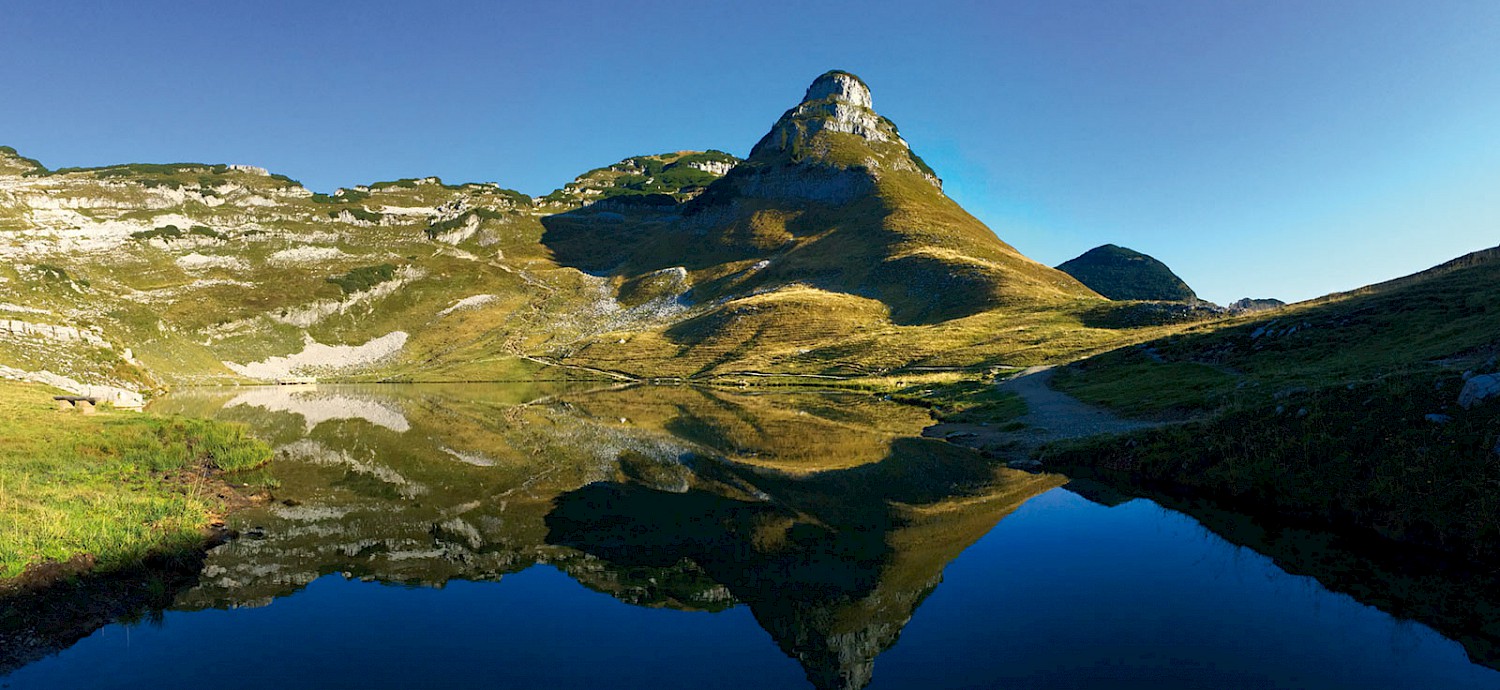
Loser summit 1,838m
Starting from the Loseralm car park, walk along the Augstsee lake on trail no. 256 or no. 3.
Passing the Loserfenster, you reach the Hochanger, which offers a first panoramic view of the mountain world of the Inner Salzkammergut.
Through the mountain pine belt on the west side, you descend to Loserboden. The last ascent leads to the Loser summit at 1,838 m.
The summit is a small plateau plateau with almost unlimited panoramic views of the peaks of the Tote Gebirge, almost the entire Salzkammergut, Grimming, Dachstein, Niedere and parts of the Hohe Tauern.
| Difficulty | Moderately difficult terrain, surefootedness and good footwear required. |
| Walking time | approx. 1.5 h / difference in altitude: 314 m / length 1.9 km |
| Special experience point | Augstsee with bench, Loserfenster, Loser summit |
| Refreshment stop | Loseralm Inn |
| Accessibility | Loser panorama road (9 km) |
| Starting point | Loseralm car park at 1,600 m above sea level (end of panorama road) |
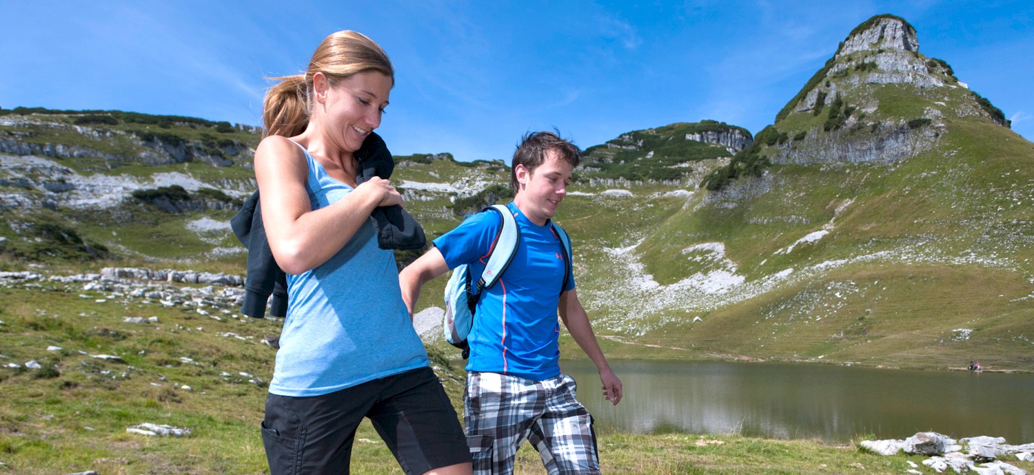
Augustsee-Circular Trail
Small jewel with wonderful views
The circular hiking trail at the Augstsee, just above the Loseralm, invites you to unwind. Naturalists gain insights into the geology of the mountains and the lake landscape of the Salzkammergut. Hikers are offered enticing panoramic views as far as the Hohe Tauern, the Dachstein, the Tote Gebirge and the Salzkammergut.
| Difficulty | Easy terrain, sturdy shoes are an advantage. |
| Walking time | approx. 45 min. / difference in altitude: 80 m / length 1.1 km |
| Special experience point | Augstsee lake with bench, Totes Gebirge summit panorama |
| Refreshment stop | Loseralm Inn |
| Accessibility | Loser Panorama Road (9 km) |
| Starting point | Loseralm car park at 1,600 m above sea level (end of panorama road) |
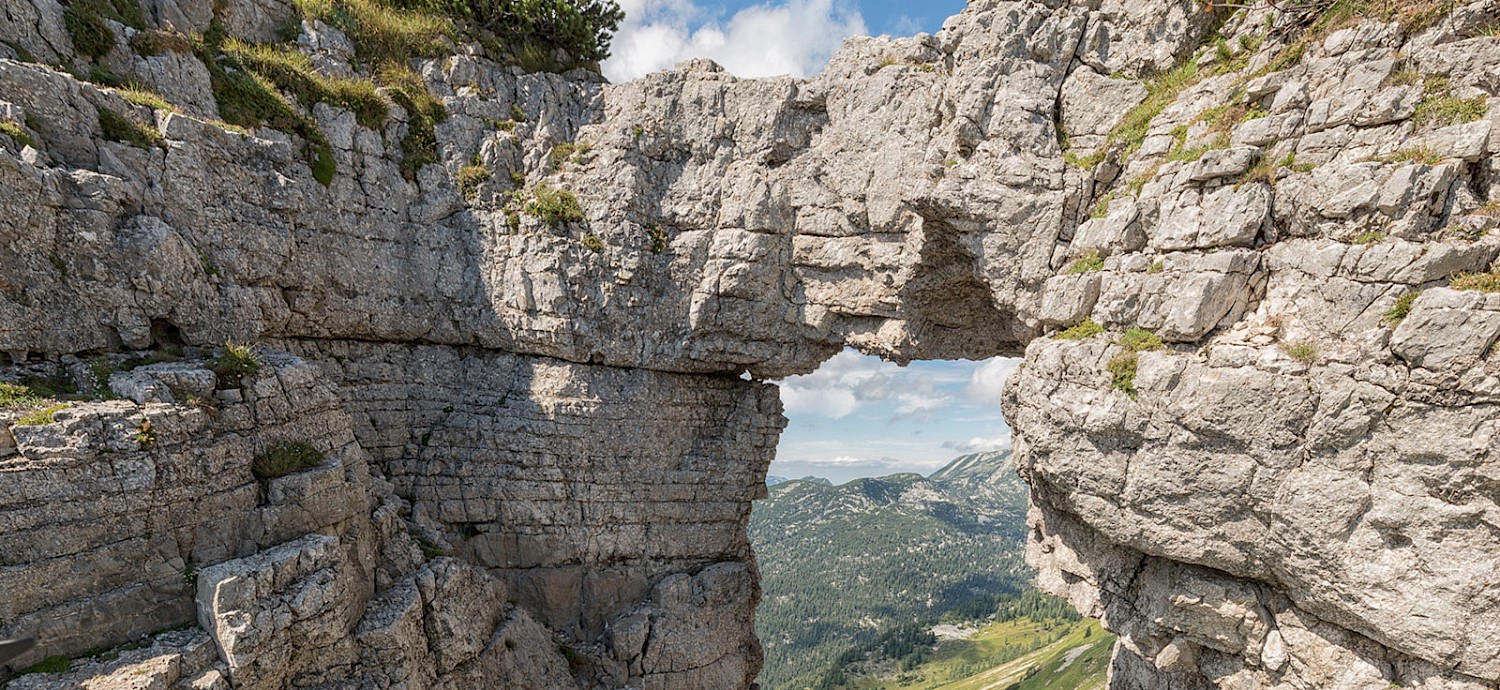
Loserfenster
One of the most famous natural phenomena is certainly the famous Loser window. The several-metre-high rock gate provides a picturesque setting for panoramic views of the Schönberg and the landscape around the Gschwandalm and Schoßboden, which stretches out beneath a huge rocky outcrop.
Starting from the Loseralm car park, hike along the Augstsee lake on trail no. 256 or no. 3.
| Difficulty | Moderately difficult terrain, surefootedness and good footwear required. |
| Walking time | approx. 1 hour / difference in altitude: 186 m / length 1 km |
| Special experience point | Augstsee with bench, Loser window, Loser summit |
| Refreshment stop | Loseralm Inn |
| Accessibility | Loser Panorama Road (9 km) |
| Starting point | Loseralm car park at 1,600 m above sea level (end of panorama road) |
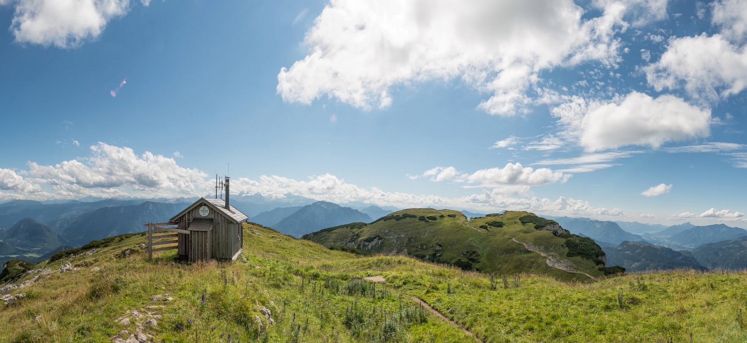
Bräuning Zinken 1,899m
Departing from the parking area at the Loseralm, you walk towards the Augstsee, passing by, to the Bräuning Alm. The trail follows a gentle climb to the Gschwander Sattel until you notice the summit pyramid, overgrown with dwarf pines, right before you and you can reach the summit from there easily. An amazing panoramic view is your reward for the ascent.
| Difficulty | Moderately difficult terrain, surefootedness and good shoes required. |
| Walking time | approx. 1.5 h / difference in altitude: 390 m / length 2.6 km |
| Special experience point | Augstsee, Bräuning Alm, Bräuning Zinken |
| Refreshment stop | Loseralm Inn |
| Accessibility | Loser Panorama Road (9 km) |
| Starting point | Loseralm car park at 1,600 m above sea level (end of panorama road) |
Bräuning Alm circular trail
Variants lead from the Loseralm car park along trail no. 2 to the Bräuning Alm. The flat and easy circular trail requires surefootedness and good footwear. The Bräuning Alm consists of several huts that are used for pasture management in summer.
| Difficulty | Easy terrain, surefootedness and good shoes required. |
| Walking time | approx. 1 hour / difference in altitude: 80 m / length 1.5 km |
| Special experience point | Augstsee, Bräuning Alm |
| Refreshment stop | Loseralm Inn |
| Accessibility | Loser Panorama Road (9 km) |
| Starting point | Loseralm car park at 1,600 m above sea level (end of panorama road) |
Greimuth 1,878m; via Augtsee
ONLY FOR EXPERIENCED HIKERS!
From the Loseralm car park past the Augstsee lake, trail no. 4 leads to the saddle between Atterkogel and Greimuth. Keeping to the left, you cross a small field of mountain pines before reaching the summit pasture.
The Greimuth offers views of the mighty and steep north face of the Loser.
| Difficulty | Moderately difficult terrain, surefootedness and good shoes required. |
| Walking time | approx. 1 h / difference in altitude: 269 m / length 1.2 km |
| Special experience point | Augstsee, Greimuth, north face Loser |
| Refreshment stop | Loseralm Inn |
| Accessibility | Loser Panorama Road (9 km) |
| Starting point | Loseralm car park at 1,600 m above sea level (end of panorama road) |
4 peaks - 1 lake
Challenging circular hike
ONLY FOR EXPERIENCED HIKERS!
The four most prominent peaks of the Loser massif can be climbed in a circular hike. Starting from the Loseralm via trail no. 255 you reach the Loser summit (1,838m) in 1.5 hours. Continue over the Hochanger (1,837m) past the Loser window to the Greimuth (1,878m). On trails no. 4 and no. 257 you reach the last of the four peaks, the Bräuning Zinken (1,899m).
| Difficulty | Moderately difficult terrain, surefootedness and sturdy shoes required |
| Walking time | approx. 4 hours / difference in altitude: 900 m / length 8.5 km |
| Special experience point | 4 peaks, Loser window, Augstsee, Bräuning Alm |
| Refreshment stop | Loseralm Inn, Loser hut |
| Accessibility | Loser panorama road (9 km) |
| Starting point | Losealm car park at 1,600 m above sea level (end of panorama road) |
Hiking & mountain guides
No matter if you prefer hiking, nordic walking, snowshoeing or ski touring: our professional hiking guides make your tour around or to the peak of the Loser in Altaussee to an experience, you will never forget!
Gasperl Alfred | Remschak Christian | Markus Raich |